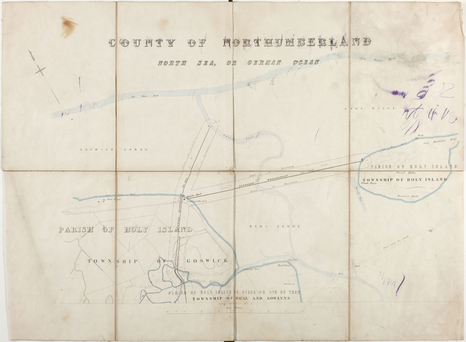
Map to illustrate plans for reclamation of land around Holy Island 1865 zoomMap to illustrate plans for reclamation of land around Holy Island, Goswick & LowlynnA map of Holy Island township in relation to Goswick and Lowlynn townships, showing plans for extended watercourse and embankment.Date of creation 1865 Date of coverage 1865 Extent 1 Place Holy Island, Goswick and Lowlynn Copyright Holy Island Archive Reference number HOL/025/002 Storage location Holy Island Reading Room Format Maps and Plans (21) Subject Holy Island Shoreline (5) No CommentsStart the ball rolling by posting a comment on this page! Add a comment about this pageYour email address will not be published. Required fields are marked *Your comment:Name * Email * I consent to my name and e-mail address being stored along with this comment, and to the website editors communicating with me by e-mail about the comment if necessary. My name may be published alongside the comment on the website, but my e-mail address will not be published. My information will not be shared with any third party (see our Privacy Statement - opens in a new window). * Δ Browse this collectionHoly IslandHoly Island Reclamation Booklet with maps regarding plans for embankments and other works for protection of Holy Island coastline 1865-66Booklet describing plans for embankments and other works for protection of Holy Island coastline 1865-66Map to illustrate plans for reclamation of land around Holy Island 1865Map to illustrate plans for reclamation of land around Holy Island 1865Map to illustrate plans for reclamation of land around Holy Island 1865 Search the archiveText searchDate searchList of subjectsList of formatsShare thisFacebookPinterestTwitterLinkedin


No Comments
Add a comment about this page